
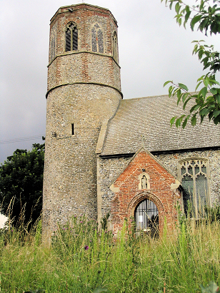
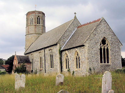
Thorpe Abbotts All Saints
|
|
1813 to 1880 Baptism Project Thorpe Abbotts All Saints |
Baptisms 1813 to 1880
|
The parish of Thorpe Abbotts (there is some dispute
regarding the number of "t's" in that word, we follow modern
Ordnance Survey in giving it 2) has the distinction of having
within the parish the southernmost piece of land in Norfolk, the
parish forms part of the border with neighbouring Suffolk and is
formed by the course of the River Waveney. Thorpe Abbotts lies
roughly 6 miles east of the market town of Diss, the village
sitting just over a half mile north of the busy A143 road which
follows the Norfolk/Suffolk border from Diss through to Bungay
& Beccles. Thorpe Abbotts position in the valley of the
Waveney gave its farming a more diverse character than is normal
for the county, the riverside water-meadows providing grazing
for, mainly, cattle as well as higher ground being typically
arable and dominated by cereals. |
 |
 |
|
| A single standard 800-entry register book
covers not only the period of this transcript but runs onward to
completion in the early 20th century. This register is filmed on
Microfilm MFRO710 in the collection of Norfolk Record Office, in
addition to this legacy filming digitised imagery of this register
can be found, for those with appropriate subscriptions, on most of
the major commercial sites. Keen eyed readers will note the
substantial gap in the numbering, the incumbent of the day was
also keen to defer any criticism as he makes the point that those
pages were missing when he acquired the book less he be accused of
its desecration. Across all the images this was, therefore, a
straightforward piece to prepare. |
Back 1820 1830 1840 1850 1860 1870 1880
Back 1820 1830
1840 1850 1860
1870 1880
Corrections to Tinstaafl
Transcripts