
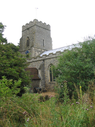
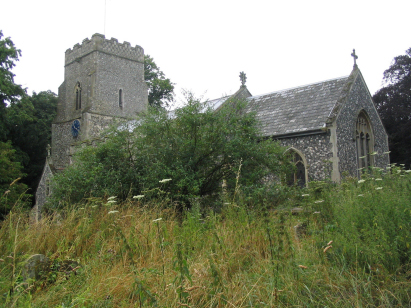
Starston St Margaret
| |
1813 to 1880 Baptism Project Starston St Margaret |
Baptisms 1813 to 1880
|
The parish of Starston is located in southern Norfolk
about 2 miles northwest of the market town of Harleston and 7 miles northeast
of the market town of Diss. Starston lies on the broad lane which links
Harleston through the Pulhams to the busy A140 Norwich to Ipswich road.
It lies just as you climb out of the valley of the River Waveney, which
forms the border with Suffolk. Starston is an agricultural community and
perhaps has always been thus. The landuse is dominated by arable farming
notably of grains but also of beet and oil seed. Starston sits in a shallow
valley, a brook heads eastwards to join the Waveney at Wortwell, but the
land all around rises to form a fairly level plateau which stretches northwards
towards Long Stratton & Hempnall. Starston was quite densely populated
at the time of this transcript but nowadays probably has a smaller population,
most of it grouped around the main crossroads of the village. |
 |
 |
|
| Two standard 800-entry register books cover the period of the transcript although this is difficult to spot as the second in not prenumbered and the clerk continues the numbering from the first book. The first book runs to 1876, the second continues until the late 20th century. Both registers are filmed on Microfilm MF1405 in the collection of Norfolk Record Office which was used to prepare this transcript. The film is a modern one and benefits from the higher standards achieved recently. This is needed as at times the handwriting is scruffy and the entries for a handful are tricky to read. Hopefully few errors will have been made in reading those entries. |
Back 1820 1830 1840 1850 1860 1870 1880
Back 1820 1830 1840 1850 1860 1870 1880
Corrections to Tinstaafl Transcripts