
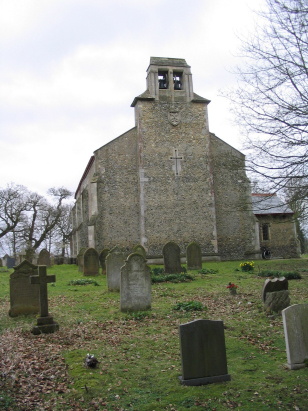
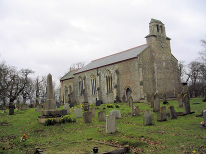
Smallburgh St Peter
| |
1813 to 1880 Baptism Project Smallburgh St Peter |
Baptisms 1813 to 1880
|
The parish of Smallburgh sits in eastern Norfolk about
2 1/2 miles west of the small market town of Stalham. Smallburgh sits
on the busy A149 road which connects North Walsham with Great Yarmouth
and sits on the southern banks of a small tributary of the River Ant where
that road crosses to its mirror image neighbour Dilham. Smallburgh has
most of its properties along the A149 together with adjacent lanes heading
both east & west along the course of that stream. Like much of Norfolk
Smallburgh would largely have earned its living from arable farming, the
river meadows would have provided some variation as would river transportation
of goods along the nearby Ant. The land is fairly level around the village,
barely 10 metres above sea level and very suitable for cereals, oil seed
and beet. Like many Broadland parishes Smallburgh was relatively small,
covering just 1,250 or so acres. |
 |
 |
|
| Sadly not all baptismal registers covering the period of this transcript have been deposited. A single 800-entry register book, missing its first page, covers up to 1863 thereafter the records have been drawn from the incomplete Bishops Transcripts. The register is filmed on Microfiche 12 & 13 in the collection of Norfolk Record Office but these elderly fiche are poor in quality and instead online imagery at Familysearch (also available on the two main commercial providers) was used to prepare this transcript. The quality of the BTs was better then normal but users should note that 1875, 1879 & 1880 are missing or never produced. Should the register covering the period 1863 onwards be deposited then this transcript will be rechecked and completed. |
Back 1820 1830 1840 1850 1860 1870
Back 1820 1830 1840 1850 1860 1870
Corrections to Tinstaafl Transcripts