
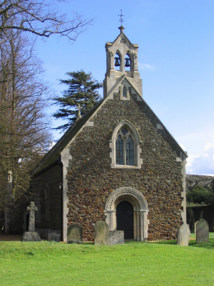
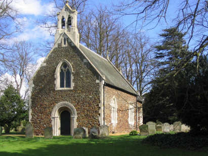
Shouldham Thorpe St Mary
| |
1813 to 1880 Baptism Project Shouldham Thorpe St Mary |
Baptisms 1813 to 1880
|
The parish of Shouldham Thorpe lies in western Norfolk
about 5 miles northeast of the market town of Downham Market. Shouldham
Thorpe, about a mile southwest of its larger neighbour Shouldham, is little
more than a hamlet set just east of the A134 road which connects King's
Lynn with Thetford. Shouldham Thorpe is one of a number of settlements
which formed along the western edge of dryer land overlooking Norfolk's
Fenland to its west. The soils here are sandy and light (this is really
an extension of Breckland) and thus suitable for arable agriculture in
the days before heavy machinery. The area around Shouldham Thorpe is a
broad plateau at around 30 metres above sea level with very few contours
marking the map, it is thus very suitable for the large machine cultivated
fields of today although prey to wind-blow of the light soils. |
 |
 |
|
| Unfortunately the post-1813 baptismal register has yet to be deposited with Norfolk Record Office. The entries shown here were recorded from the Bishop's Transcripts which survive, unfortunately there are non beyond 1867 so 13 years are currently missing from the transcript. The transcript was prepared from both microfiche image and also digital images (held on Familysearch) due to the poor quality of some images on fiche. Hopefully the choice of media will limit any misreads. Should the register eventually reach the public domain the transcript will be rechecked and completed replacing these current entries. |
Corrections to Tinstaafl Transcripts