
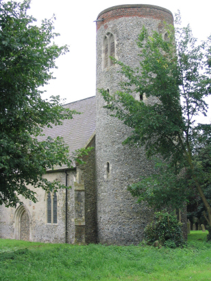
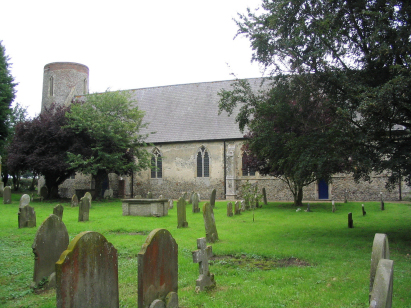
Norton Subcourse St Mary
|
|
1813 to 1880 Baptism Project Norton Subcourse St Mary |
Baptisms 1813 to 1880
|
The parish of Norton Subcourse
lies in southeastern Norfolk not too far from its border with
neighbouring Suffolk. Norton Subcourse is located about 3 miles
east of the small market town of Loddon and sits a mile north of
the B1136 road which cuts off the corner between the
Loddon/Beccles road and the Great Yarmouth/Beccles road. Norton
Subcourse is a small village, one of a pair with Thurlton which
sit either side of their joint staithe, Boyce's Dyke, a
water-course designed to allow the bringing of boats into the
margins of nearby villages. Norton Subcourse sits at the very edge
of Norton Marshes which stretch north the two miles or so to the
course of the River Yare which marks the northern boundary of the
parish. This position gave the parish not only dry land for arable
cropping but also extensive grazing marshes and wetlands for the
traditional trades of wildfowling & reed thatch harvesting,
the staithe gave it access to the wider Broadland waterway network
allowing transportation to the port of Great Yarmouth and upstream
to the city of Norwich. |
 |
 |
|
| A single standard 800-entry register book covers the period of this transcript and runs on to completion in 1891, this register is filmed on Microfilm MF1704 in the collection of Norfolk Record Office. In addition to this traditional resource digitised imagery is available online, free to view on Familysearch and for those with appropriate subscriptions on the major commercial sites. Given these resources this was a straightforward piece to prepare. The clerical standard is a little wobbly at times with 2 entries having incomplete dating and the odd marginal infill too. |
Back 1820 1830 1840 1850 1860 1870 1880
Back 1820 1830
1840 1850 1860
1870 1880
Corrections to Tinstaafl
Transcripts