
Howe St Mary
|
|
1813 to 1880 Baptism Project Howe St Mary |
Baptisms 1813 to 1880
|
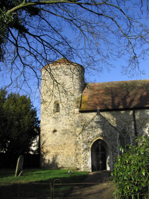
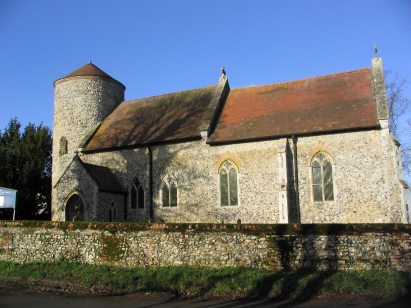
The parish Howe lies southeastern Norfolk roughly 7
miles southeast of the city of Norwich. Howe is a tiny place
which sits just under a mile west of the B1332 road which links
Norwich with the Suffolk market town of Bungay. Whilst Howe may
be little more than a hamlet it incorporated the even smaller
place of Little Poringland in ancient times, even collectively
their joint population barely amounted to 100 folk. Much of Howe
consists of a short strip of properties either side of the
church and mostly on the lane's northern side, the narrow lane
heads west from the B1332 towards Shotesham. Like most rural
parishes in this area of Norfolk it was arable farming which
largely sustained this small congregation, and today little has
changed with big fields of cereals, beet and oil-seed dominating
the local landscape. Despite the commuter growth of its near
neighbour, Poringland (earning it the local smear of
"Boringland"), Howe remains a tiny rural settlement gathered
around its ancient church, the whole parish only covers 760
acres. |
 |
 |
|
| A single standard 800-entry register book
covers the whole of the transcript period and runs onward to
finish in the early 21st century, indicative of the small size of
the congregation. As a very recent deposit there is no legacy
microform made of this register, it has bypassed straight into the
modern age of digital imagery which has recently become available
for those with appropriate subscriptions on most of the major
commercial sites. It was necessary to view the original register
to avoid infringing subscription restriction clauses in preparing
this transcript despite NRO's reluctance to allow handling of the
document. Consequently there were no legibility issues in
preparing this transcript. |
Back 1820 1830 1840 1850 1860 1870 1880
Back 1820 1830
1840 1850 1860
1870 1880
Corrections to Tinstaafl
Transcripts