
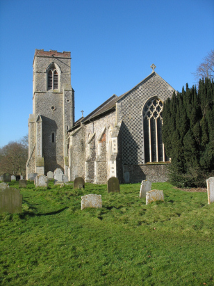
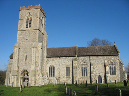
Hardingham St George
| |
1813 to 1880 Baptism Project Hardingham St George |
Baptisms 1813 to 1880
|
The parish of Hardingham lies in central Norfolk, about
5 miles northwest of the market town of Wymondham and northeast of the
substantial village of Hingham. The village lies in the lanes west of
the junction of two B roads the B1108 which links Norwich to Watton and
the B1135 which links Wymondham to East Dereham. This area is a broad
agricultural plateau roughly 50 metres above sea level and dominated by
arable farmland. A scatter of lanes runs through the big fields under
wide open skies. The village of Hardingham has all the characteristics
of a settlement that has migrated through time, it is over a mile southeast
of where its mediaeval forebear was probably located. The presence on
the map of both "the Hall" and "the old Hall", the
latter close to the church is perhaps indicative. |
 |
 |
|
| Two standard 800-entry register books cover the period of the transcript which the second continuing beyond to 1939. Both registers are filmed on Microfiche 6 to 8 in the collection of the Norfolk Record Office and from which this transcript was prepared. The fiche are elderly and the images do not show the quality to be expected, however the registers must have been in excellent condition and well written as despite the image quality this proved a straightforward transcript to prepare. Hopefully few errors will have crept in to its production. |
Back 1820 1830 1840 1850 1860 1870 1880
Back 1820 1830 1840 1850 1860 1870 1880
Corrections to Tinstaafl Transcripts