
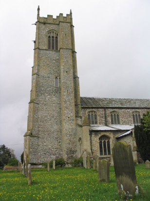
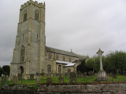
Grimston St Botolph
| |
1813 to 1880 Baptism Project Grimston St Botolph |
Baptisms 1813 to 1880
|
The parish of Grimston is located in western Norfolk about
7 miles northeast of the port of Kings Lynn. Grimston is a large and compact
village sited on the B1153 road which runs from Narborough to Docking.
Grimston is one of a series of villages built along the western edge of
the northwest Norfolk ridge of higher ground formed by the underlying
chalk. Originally a springline settlement these villages have extended
parishes east to west to take in both the higher ground, where sheep pastures
would have predominated, and the lower western areas of sandy, lighter
soils for arable agriculture. Grimston lines the B1153 and has extended
westwards to almost absorb its smaller western neighbour Roydon. Sheep
would have predominated at the time of this transcript and the map clearly
shows many droveways headed from Grimston eastwards into the higher ground
and used to transport animals to the village and onwards to Kings Lynn
and other markets. |
 |
 |
|
| Three standard 800-entry register books cover the period of this transcript, these registers were deposited only in 2016. The first two books are filmed on Microfilm MFRO771, the third on MFRO772. These films benefit greatly from the modern filming techniques available and are excellent examples of the format. As a consequence this was a very straightforward piece to prepare throughout and it is hoped few errors will have been committed in its production.. |
Back 1815 1820 1825 1830 1835 1840 1845 1850 1855 1860 1865 1870 1875 1880
Back 1815 1820 1825 1830 1835 1840 1845 1850 1855 1860 1865 1870 1875 1880
Corrections to Tinstaafl Transcripts