
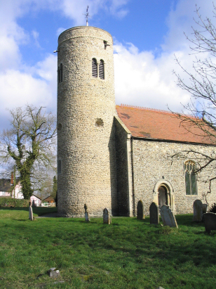
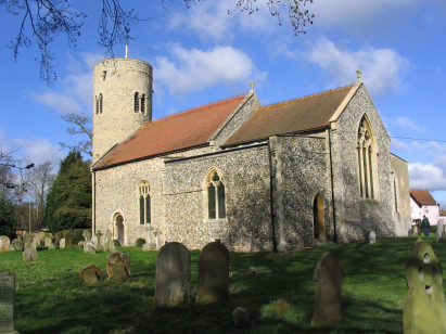
Gissing St Mary
| |
1813 to 1880 Baptism Project Gissing St Mary |
Baptisms 1813 to 1880
|
The parish of Gissing lies in south Norfolk about 3 miles
north of the market town of Diss. Gissing is a rather spread-out village
lying in lanes to the west of the busy A140 road which links Norwich with
Ipswich and also west of the main Norwich to London main railway line.
The area around Gissing is dominated by arable agriculture, cereals and
crops such as oil seed & sugar beet dominate in large and largely
flat open fields. Gissing sits on an area of Norfolk that is largely a
plateau with few contours for miles and land gently sloping towards the
valley of the River Waveney a few miles to the south. The notional centre
of Gissing is in the group of properties around the church and pub, a
social centre for what is a dispersed community. |
 |
 |
|
| Two standard 800-entry register books cover the period of this project. The first is filmed on Microfilm MFRO96, the second, which runs into the 20th century, is on Microfilm MF1630. Both films are relatively recent filmings and show the better quality which is achievable in recent times. As a result there were clear and readable images and the handwriting also was acceptable making for a straightforward piece to prepare. |
Back 1820 1830 1840 1850 1860 1870 1880
Corrections to Tinstaafl Transcripts