
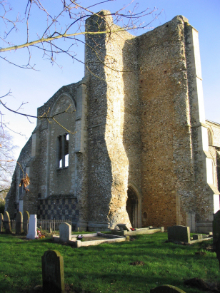
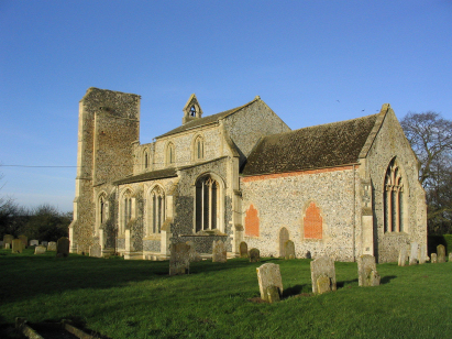
Little Cressingham St Andrew
|
|
1813 to 1880 Baptism Project Little Cressingham St Andrew |
Baptisms 1813 to 1880
|
The parish of Little Cressingham
lies in the southwestern portion of central Norfolk roughly 3
miles west of the small market town of Watton. Little Cressingham
is a small crossroads village which sits immediately west of the
B1108 road which links Watton through to the main Swaffham to
Brandon road (A1065). Little Cressingham is a small and compact
settlement with properties edging the B1108 as well as being
grouped around the crossroads of narrow lanes which form the
centre of the village. Little Cressingham is particularly noted
for its Georgian windmill, a unique arrangement of a tower mill
combined with a water-wheel and situated on the small tributary of
the River Wissey that flows to the north of the village. Little
Cressingham sits on the northern edges of both Breckland and the
Army range of Stanta Battleground both of which lie to the south,
despite the relatively light soils of Breckland this was an arable
parish in the main with early gazetteers describing over 70% of
the parish acreage set to cereals and similar crops. Hikers will
be familiar with Little Cressingham as the tiny village marks the
end of the Breckland stretch of the Peddar's Way National Trail,
passing through the village on its way to the North Norfolk coast.
|
 |
 |
|
| A single standard 800-entry register book covers not only the period of this transcript but runs onward to completion in the late 20th Century. This register is filmed on Microfilm MF1642 in the collection of Norfolk Record Office which was used to prepare this transcript. In addition to this legacy resource for those with appropriate subscriptions digitised imagery can be viewed on the major subscription sites. As a consequence this was straightforward piece to prepare. |
Back 1820 1830 1840 1850 1860 1870 1880
Back 1820 1830
1840 1850 1860
1870 1880
Corrections to Tinstaafl
Transcripts