
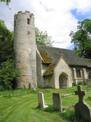
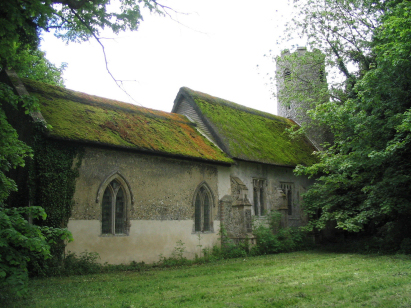
Cranwich St Mary
|
|
1813 to 1880 Baptism Project Cranwich St Mary |
Baptisms 1813 to 1880
|
The parish of Cranwich lies in
southwestern Norfolk roughly 6 miles north of the Suffolk market
town of Brandon. Cranwich sits on the A134 road, which connects
Thetford with King's Lynn midway between Mundford and Northrepps.
Cranwich is a tiny place with just a few farms and cottages
stationed along either side of the A134 and with no defined
village as such. Cranwich stands upon the light and infertile
soils of Breckland and much of the parish was set to heath and
common whilst only a little over 50% of the acreage could be used
as arable farming, a few pastures by the nearby River Wissey and
warrenries completed the land use. Today much of the parish, in
particular that south of the A134 is set to forestry with conifer
plantations covering much of the land. |
 |
 |
|
| A single standard 800-entry register book covers not only the period of this transcript but runs onward to completion at the end of the 20th century. This register is filmed on Microfilm MF1841 in the collection of Norfolk Record Office. The film is a modern one with all of the benefits of clearer images attainable by today's cameras. In addition to the filmed copy, digitised imagery is available online to subscribers of the main commercial web sites. |
Back 1820 1830 1840 1850 1860 1870 1880
Back 1820 1830
1840 1850 1860
1870 1880
Corrections to Tinstaafl
Transcripts