
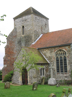
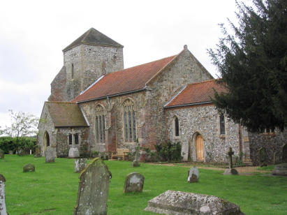
Ashwicken with Leziate All Saints
|
|
1813 to 1880 Baptism Project Ashwicken with Leziate All Saints |
Baptisms 1813 to 1880
|
The parish of Ashwicken, it was
united with Leziate in the late 15th century, lies in western
Norfolk roughly 5 miles east of the port of \King's Lynn.
Ashwicken sits on and south of the B1145 road which runs west to
east from King's Lynn across to Bawdeswell. The road follows a
strip of slightly higher land and this emergence above low-lying
and marshy ground is where the settlement arose. The soils here,
however, are poor and underlain with the narrow outcrop of
Carrstone, an iron-rich but nutrient poor sandstone. The farming
here was a mixture of arable and pastoral with some land managed
for woodland but with other areas set to heathland. The sands and
gravels deposited by retreating glaciers have, however, been
attractive for road-building and numerous pits, particularly at
Bawsey have been opened to extract these materials. Ashwicken was
a relatively modest parish with few parishioners, the location of
the church close to the hall is perhaps indicative of an estate
parish with most land held by a single landholder, this tends to
prevent a distinct village growing up. |
 |
 |
|
| A single 800-entry register book covers not only the period of this transcript but runs onwards to completion in 1882. This register is filmed on Microfilm MFRO710 in the collection of Norfolk Record Office. This film is a modern one which shows the improved quality of image available from digital techniques. In recent times for those with appropriate subscriptions images have appeared of this register on most of the major commercial sites. The register has suffered some damage with water-staining by the spine of many pages but this does not significantly impact legibility making for a straightforward piece to prepare. |
Back 1820 1830 1840 1850 1860 1870 1880
Back 1820 1830
1840 1850 1860
1870 1880
Corrections to Tinstaafl
Transcripts