
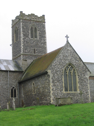
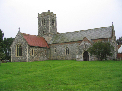
Aldeby St Mary
|
|
1813 to 1880 Baptism Project Aldeby St Mary |
Baptisms 1813 to 1880
|
The parish of Aldeby lies in the
extreme southeast of Norfolk, forming a stretch of the border,
here formed by the River Waveney, with neighbouring Suffolk.
Aldeby is located roughly 3 miles northeast of the Suffolk market
town of Beccles and sits in lanes just over 2 miles east of the
A143 road which links Beccles with Great Yarmouth. Aldeby sits
upon a peninsula of Norfolk which pokes into adjacent Suffolk, a
peninsula formed between the arms of a large meander of the river
Waveney. Aldeby would have utilised both the water-meadows
bordering the river as well as the more dry land slightly higher
to give it a more varied farming regime than is typical of either
of the two counties. The water-meadows providing rich grazing
whilst the dry sandy soils were ideal for arable crops, notably
cereals. Aldeby is a slightly dispersed settlement, a
concentration of properties along St Mary's Road aside, it is a
scatter of farms and cottages across a wide area, indeed Aldeby
parish was rather large by eastern Norfolk standards, covering
just over 3,000 acres it was almost twice the size of most
Broadland parishes. |
 |
 |
|
| Two standard 800-entry register books cover the period of this transcript, the second continuing to completion in 1908. Both books are filmed on Microfilm MFRO14B in the collection of Norfolk Record Office and both have online digitised images on the major subscription web sites allowing for a straightforward piece to prepare. The clerical standard, at times, is poor with rather scruffy pages making for a possibility of some misreads. |
Back 1820 1830 1840 1850 1860 1870 1880
Back 1820 1830
1840 1850 1860
1870 1880
Corrections to Tinstaafl
Transcripts