
England
& Wales Hardwicke Marriage Index
Marriages
1754 - 1837
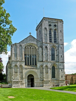
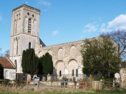
Old Malton St Mary
| |
England
& Wales Hardwicke Marriage Index |
The ParishThe parish of Old Malton lies in the northeastern portion of central Yorkshire roughly 19 miles northeast of the city of York and on the southern edge of the North Riding where it borders the East Riding, here the border is formed by the River Derwent. Old Malton used to stand on the route of the A64 road which links York with both Pickering & Scarborough but thankfully that road now bypasses the small town to its north. Old Malton is the earliest part of a complex settlement involving the larger New Malton and, across the Derwent, the more workaday settlement of Norton. There is a long history of settlement in this location, the Romans choose it for their 1st century fortress of Derwentia, the site sitting midway between Old & New Malton. Old Malton grew firstly as a monastery town following the foundation of its Gilbertine priory in c1150, a small market town grew up alongside and served its region as a centre for trade and specialist skills. Throughout the Middle Ages this income from the market was expanded as the Derwent was navigable and a small inland port added to the town's income. Beyond the small town's limits the wider parish would have been farmed largely by pastoral means, the low-lying riverside meadows bearing rich cattle grazing. Old Malton had a short-lived spurt from the discovery of the efficacy of its spring waters and was also noted for its horse race course, both now disappeared. It is somewhat ironic that the first settlement here is nowadays the smallest of the three with both New Malton and Norton exceeding it both size and function. Modern developments have come near with the railway line from York to Scarborough, unfortunately for Old Malton it sticks strictly to the East Riding in its passage. The A64 bypass is now a speedy dual-carriageway which has markedly reduced the traffic dead-lock which once flourished. Old Malton is drained southwestwards by the Derwent which meets with all of the Dales' rivers to eventually turn eastwards to the North Sea arriving through the Humber Estuary. Old Malton is sited at just 20 metres above the sea, easterly views are dominated, however, by the rising ground of Thorpe Bassett Wold which reaches just a metre short of 200 metres at its highest point. The combined acreage of Old & New Malton comprises just over 4,000 acres of which that of Old Malton is mapped by Phillimore as just under; half other references give almost the entire acreage to Old Malton with the two parishes of New Malton given a token size, we choose to follow Phillimore, this acreage would have supported a population of around 1,200 parishioners. In Domesday times Old Malton was recovering from King William's "Harrowing of the North" and in 1086 was largely "waste", held by the King the manor had recovered to support 6 ploughs. |
 |
|
|
|
| Register No | Covering Dates | Deposited With | Register Style | Quality Standard | Comments |
| 1 |
18th May 1754 - 23rd December 1811 |
Borthwick Institute - York - Reference - PR/O/M/8 |
Standard preprinted and self-numbered Marriage register
with 4 entries per page |
Grade 2 Register - not a perfect read but with a low
likelihood of misreads |
None |
| 2 | 11th January 1813 - 22nd May 1837 | Borthwick Institute - York - Reference - PR/O/M/9 | Standard Rose style preprinted and prenumbered Marriage register | Grade 2 Register - not a perfect read but with a low likelihood of
misreads |
None |
|
Kirby
Misperton St Lawrence
|
Pickering
St Peter & St Paul
|
Rillington
St Andrew
|
|
New
Malton St Michael
New Malton St Leonard |
 |
|
|
New Malton St Michael New Malton St Leonard |
Norton
St Peter
|
1760 1770 1780 1790 1800 1810 1820 1830
Corrections to Tinstaafl Transcripts