
England
& Wales Hardwicke Marriage Index
Marriages
1754 - 1837
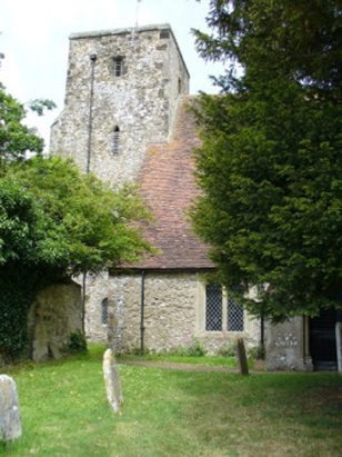
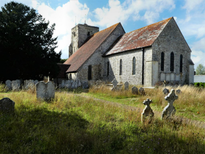
Amberley St Michael
| |
England
& Wales Hardwicke Marriage Index |
The ParishThe parish of Amberley lies in the southwestern portion of central Sussex roughly 5 miles north of the market town of Arundel. Amberley sits about 1 1/2 miles east of the A29 road which connects Arundel with London. The village consists of a single long street running from the ruined castle at its western end for almost a mile eastwards with most properties concentrated at the western end. The village occupies a strategic position witting in the mouth of the gap in the South Downs formed by the River Arun, to the southeast the Downs rise dramatically whilst to the north of the village lie the wetlands of Amberley Wild Brooks, a nature reserve. The castle was obviously placed to plug the gap changing usage from being a manor house of the bishops of Chichester to being largely fortified in the 14th century, the curtain wall from that expansion being the most spectacular remains today and a tourist draw. The contrasting geography would have given the parish a varied farming regime, cattle grazing the wet grounds to the north, sheep grazing the thin turf of the Downs whilst patches of arable would have been on drier and more productive ground. Modern developments arrived in the form of the railway line linking the capital with Arundel which grants Amberley one of the land's most picturesque stations betwixt river and Down. The landscape, the station and the crossing of the Arun make it very attractive to hikers with the South Downs Way National Trail passing through, Amberley being a popular overnight spot for that route. The Arun drains the parish southwards passing through Arundel to reach the English Channel at Littlehampton. Amberley is sited at between 5 and 35 metres above the sea, the village rising gently eastwards, to the south the South Downs rise as an escarpment to local heights of 193 metres on nearby Rackham Hill. Amberley parish was towards the larger end of the scale for its area, covering almost 2,900 acres it would have supported a population of around 700 parishioners. Held by the bishops of Chichester Amberley was already a major settlement in Domesday times being of sufficient size to be placed amongst the largest 20% of settlements by population, its assets of 24 ploughs indicated the nature of the holding with only token meadows and woodland to back that intense farming activity. |
 |
|
|
|
| Register No | Covering Dates | Deposited With | Register Style | Quality Standard | Comments |
| 1 |
18th July 1754 - 12th July 1763 |
West Sussex Record Office - Reference - Par3/1/1/3 |
Plain, ruled book containing combined Banns &
Marriages |
Grade 5 Register - the condition of this register is such
that the transcript carries a "health warning" as to the
likelihood of being substantially incorrect |
This book is severely damaged by water making for a mostly
unreadable set of records, BTs were used to improve the quality of
this transcript |
| 2 | 4th March 1764 - 20th October 1812 | West Sussex Record Office - Reference - Par3/1/1/4 | Standard preprinted and self-numbered Marriage register with 4 entries per page | Grade 4 Register - there are notable quality issues with this
register which may have resulted in many misreads |
Prior to 1799 this is a poorly kept register with incomplete data
on many records and some consisting merely of a pair of signatures
and a partial or whole date, a lazy clerk indeed. After 1799 the
register is of a very good quality. |
| 3 | 8th June 1813 - 15th May 1837 | West Sussex Record Office - Reference - Par3/1/3/1 | Standard Rose style preprinted and prenumbered Marriage register | Grade 1 Register - Few issues noted and a low likelihood of misreads | None |
|
Coldwaltham
St Giles
|
Hardham
St Botolph
Wiggonholt |
Wiggonholt
|
|
Bury St
John the Evangelist
|
 |
|
|
Houghton
St Nicholas
|
North
Stoke St Mary
|
Burpham
St Mary
|
1760 1770 1780 1790 1800 1810 1820 1830
Corrections to Tinstaafl Transcripts