
England
& Wales Hardwicke Marriage Index
Marriages
1754 - 1837
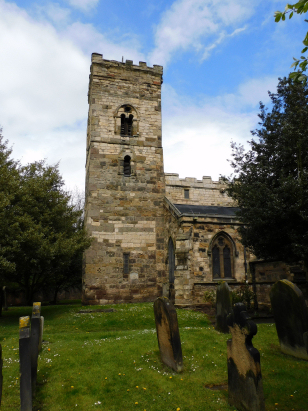
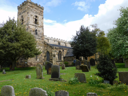
Billingham St Cuthbert
| |
England
& Wales Hardwicke Marriage Index |
The ParishThe parish of Billingham lies in the extreme southeast of County Durham forming not only a stretch of the county's North Sea coastline but also, across the estuary of the River Tees, the border with neighbouring Yorkshire. Billingham sits about 3 miles northeast of the industrial town of Stockton on Tees and immediately east of the busy A19 road which links Tyneside with the A1, Great North Road just beyond Thirsk. Billingham is a much changed place, old maps depict a small and compact settlement of a few hundred folk gathered neatly around St Cuthbert's church, it is industrial development that has created the urban metropolis of today's Billingham. Immediately following the Norman conquest a grange, a monastic farm complex, subsidiary to Durham Cathedral sat here and a small farming community went largely unchanged until the coming of the first railways. During Victorian times the discovery of recoverable iron deposits lead to the opening of Bell Brothers iron-works, growth spurted following the discovery of rock salt below the growing settlement and the Teesside salt extraction industry began. The presence of industrial activity, the port of Port Clarence and cheap land encouraged ICI to place their chemical plant on the northern banks of the Tees Estuary within the parish creating the public expectations of Billingham in consequence. At the time of this transcript all of this stood in the future as the community farmed mainly pastorally and exploited the estuary for its fish & shellfish. With industrial growth came modern developments, the railway line linking Port Clarence to the first passenger line cane in the 1830s and was followed by lines to Hartlepool as well as freight only lines serving the industry, in addition the A19 has been upgraded to a fast dual-carriageway highway drawing much traffic from the crowded Great North Road. As a coastal community Billingham is drained readily into the adjacent Tees and its estuary headed for the nearby North Sea. Billingham is sited at 20 metres above the sea or below in rather flat terrain, land rises gently northwestwards reaching around 60 metres within a couple of miles. Billingham parish incorporated the chapelry of Wolviston but was still extensive, the parish covered just over 5,400 acres and would have supported a population prior to the industry of around 1,600 parishioners, the population in the early 20th century exceeded 35,000. The northern limit of Domesday Book's coverage in eastern England is formed by the course of the Tees, as Billingham sits north of that line it has no mention in that tome. |
 |
|
|
|
| Register No | Covering Dates | Deposited With | Register Style | Quality Standard | Comments |
| 1 |
21st May 1754 - 11th October 1812 |
Durham Record |Office - Reference - EP/Bi/1/6 |
Plain, ruled & margined book containing combined Banns
& Marriages |
Grade 2 Register - not a perfect read but with a low
likelihood of misreads |
None |
| 2 | 21st January 1813 - 10th June 1837 | Durham Record |Office - Reference - EP/Bi/1/7 | Standard Rose style preprinted and prenumbered Marriage register | Grade 2 Register - not a perfect read but with a low likelihood of misreads | None |
|
Elwick
Hall St Peter
Greatham St John the Baptist |
Greatham
St John the Baptist
|
|
|
Grindon
St James the Great
Norton St Mary the Virgin |
 |
|
|
Norton
St Mary the Virgin
|
|
1760 1770 1780 1790 1800 1810 1820 1830
Corrections to Tinstaafl Transcripts