
England
& Wales Hardwicke Marriage Index
Marriages
1754 - 1837
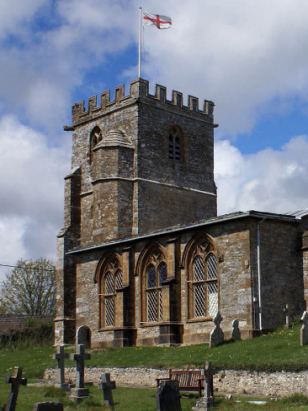
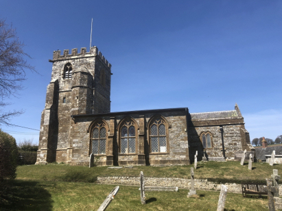
Toller Porcorum St
Peter & St Andrew
| |
England
& Wales Hardwicke Marriage Index |
The ParishThe parish of Toller Porcorum lies in western Dorset roughly 10 miles northwest of the county town of Dorchester. Toller Porcorum sits a half mile southwest of the A356 road which links Maiden Newton with the Somerset town of Crewkerne. Toller Porcorum is a small village which sits within the fork formed by the joining of the River Hooke with a side-stream, most properties lay within the triangle of flattish land that here forms, the village has spread from that core to the south across the side-stream as a spur of properties trending southwestwards. The farming landscape was largely governed by the topography of the area, Toller Porcorum sits in a valley with rich pastures suitable for cattle but is surrounded to both north and south by rolling chalk downs once the home of extensive flocks of sheep but today more arable. In earlier times, however, the qualifier Porcorum came from the regions strong connection with pigs. In addition to pastoral farming the chalk was exploited for burning for lime and the flint extensively used as building stone. Modern developments did arrive at the parish, at one time Toller Porcorum had a station on the branch railway line connecting Bridport to the main line at Maiden Newton but that is closed and largely disappeared. After little more than 2 to 3 miles the River Hooke meets the Frome and heads of southeast, turning east after passing Dorchester it eventually meets the English Channel through Poole Harbour. Toller Porcorum rises from around 110 metres at its stream side to 140 metres at its southwestern edge, land rises in billowing chalk downs around the village reaching 252 metres on hill-fort topped Eggardon Hill to its southwest. Toller Porcorum was an extensive parish, one of the largest in its area covering a little over 3,100 acres which would have supported a population of close to 550 parishioners. In Domesday times Toller Porcorum was recorded together with its smaller neighbour Toller Fratrum as a single holding of a hunter Waleran, collectively the pair only offered 3 ploughs, meadows, pastures & woodland but did possess a mill. |
 |
|
|
|
| Register No | Covering Dates | Deposited With | Register Style | Quality Standard | Comments |
| 1 | 2nd December 1754 - 29th October 1812 | Dorset Archives & Local Studies - Reference - PE-TRP/RE/3/1 | Standard preprinted and self-numbered combined Banns & Marriage register with 4 entries per page | Grade 2 Register - not a perfect read but with a low likelihood of misreads | None |
| 2 | 22nd February 1813 - 17th May 1837 | Dorset Archives & Local Studies - Reference - PE-TRP/RE/3/2 | Standard Rose style preprinted and prenumbered Marriage register | Grade 2 Register - not a perfect read but with a low likelihood of misreads | None |
|
Hooke
St Giles
|
Rampisham
St Michael
|
Wraxall
St Mary
|
 |
||
|
West
Compton St Michael
|
West
Compton St Michael
|
1760 1770 1780 1790 1800 1810 1820 1830
Corrections to Tinstaafl Transcripts