
England
& Wales Hardwicke Marriage Index
Marriages
1754 - 1837
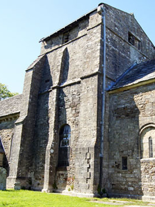
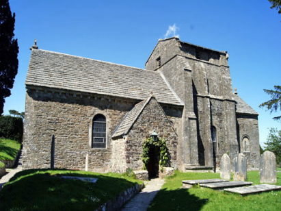
Studland St Nicholas
| |
England
& Wales Hardwicke Marriage Index |
The ParishThe parish of Studland lies in the extreme southeast of Dorset forming a lengthy stretch of the county's English Channel coastline. Studland is located roughly 8 miles southeast of the market town of Wareham and sits at the eastern end of the B3351 road which runs to it from Corfe Castle. Studland is a mid-sized and fairly compact village sitting behind a dune-fringed coastline in the shelter of the chalk outcropped headland of Old Harry Rocks, the terminus of Ballard Down, most early properties are gathered between the B3351 and the church with more modern developments spreading into the dune field. Despite lacking a formal harbour Studland was an important anchorage, its eastward facing coastline together with the shelter of the headland providing safe anchorage from the prevailing weather. Inland the parish contains a geological cross-section of the steeply tilted rocks of the area, the south, sitting on chalk, given over to sheep pasture, whilst the north, on poor quality soils largely used for woodland management. The wider parish includes Brownsea Island, within Poole Harbour, for a long time a major defensive position but today a refuge for red squirrels. Today's Studland earns most of its income from tourism, much of the parish is protected for wildlife whilst its extensive beach provides fun not only for traditional tourists but also for naturists on its secluded sections. Studland and its bay also marks the end (or beginning) of the South West Way National Trail with its terminus at the ferry crossing to Sandbanks a triumphant conclusion to over 600 miles of hiking. As a coastal settlement numerous streams run to the extensive dune system from where most water percolates through to the English Channel. Studland is sited at between 20 & 40 metres above the sea, land rises on to Ballard Down steeply to local high points 148 metres at its obelisk and 196 metres on Godlingston Hill further west. Studland's parish was extensive, amongst the largest in its county, of that acreage, however, early gazetteers estimate as much as 70% as being "waste" used in common for heath & forest prodicts, the parish would have supported a population of around 450 parishioners. In Domesday times Studland was a quiet backwater held by Count Robert of Mortain offering merely a pair of ploughs supported by pastures and woodland, its true nature is, however, reflected in its collection of 32 salthouses, the sea and its produce a major economic earner. |
 |
|
|
|
| Register No | Covering Dates | Deposited With | Register Style | Quality Standard | Comments |
| 1 |
2nd April 1755 - 31st August 1789 |
Dorset History Centre - Reference - PE-STD/RE/3/1 |
Standard preprinted and self-numbered combined Banns &
Marriage register with 3 entries per page |
Grade 1 Register - Few issues noted and a low likelihood
of misreads |
None |
| 2 | 11th October 1789 - 10th December 1811 | Dorset History Centre - Reference - PE-STD/RE/3/2 | Standard preprinted and self-numbered Marriage register with 4 entries per page | Grade 1 Register - Few issues noted and a low likelihood of misreads | None |
| 3 | 6th June 1813 - 12th June 1837 | Dorset History Centre - Reference - PE-STD/RE/3/3 | Standard Rose style preprinted and prenumbered Marriage register | Grade 1 Register - Few issues noted and a low likelihood of misreads | None |
|
|
|
|
|
Corfe
Castle St Edward
Swanage St Mary |
 |
|
|
Swanage
St Mary
|
Swanage
St Mary
|
Swanage
St Mary
|
1760 1770 1780 1790 1800 1810 1820 1830
Corrections to Tinstaafl Transcripts