
England
& Wales Hardwicke Marriage Index
Marriages
1754 - 1837
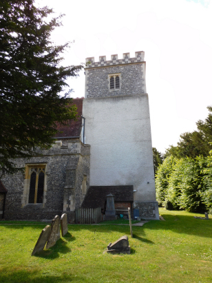
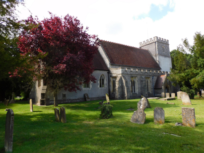
Aston Clinton St Michael
| |
England
& Wales Hardwicke Marriage Index |
The ParishThe parish of Aston Clinton lies close to the eastern edges of central Buckinghamshire about 3 miles west of the Hertfordshire town of Tring, indeed it is only the thin strip of Buckland parish that prevents Aston Clinton from forming part of the border of the 2 counties. Aston Clinton sits on the former route of the A41 road which links Aylesbury with London, that road now bypasses Aston Clinton to its north. Aston Clinton is a village which has grown significantly in modern times, early maps show the village confined to a triangular shape with the old A41 its southern limb and most properties along wither that road or the two other limbs of the "V" shaped triangle. Today Aston Clinton has expanded considerably southeastwards along the A41's former route and also infilled such that it has become contiguous with Buckland to the north. Aston Clinton is one of a number of parishes that form narrow strips descending from the crest of the Chiltern escarpment down and into the vale below, narrow from southwest to northeast yet extending for a considerable distance in the other dimension. The purpose of this arrangement was to grant the parish access to all of the differing land-forms from sheep grazing on the Chilterns and arable farming in the vale. In addition to this mixture of farming methods the local population were utilising straw to plait other products for sale. Modern developments have come to the area, Aston Clinton sits between two branch canals of the Grand Union Canal, to the south the Wendover Branch and to the north that for Aylesbury. In moving the A41 northwards it has also been upgraded into a fast dual-carriageway. Various sketchy water channel s funnel water northwards from Aston Clinton each headed for the River Thame which sweeps water westwards and then south to meet its larger target, the Thames at Dorchester, the Thames makes its way through London to the North Sea. Aston Clinton is sited on rising ground from 90 to 120 metres above the sea but southern views are dominated by the chalk escarpment of the Chilterns which rises to 260 metres on Aston Hill. Despite being narrow the parish of Aston Clinton covers a little over 3,800 acres and would have supported a population of close to 1,000 parishioners. In Domesday times Aston Clinton was just of sufficient size its 45 households made it a member of the top 20% of settlements by population, held by Edward of Sheffield its assets were extensive too, 17 ploughs, backed by meadows & woodland and also it held a mill. |
 |
|
|
|
| Register No | Covering Dates | Deposited With | Register Style | Quality Standard | Comments |
| 1 |
13th October 1754 - 22nd October 1812 |
Buckinghamshire Archives - Reference - PR8/1/3 |
Standard preprinted and self-numbered combined Banns &
Marriage register with 4 entries per page - after 1788 the
register continues on blank pages |
Grade 2 Register - not a perfect read but with a low
likelihood of misreads |
None NB this register has a printing anomaly in that only the right-hand folios are pre-stamped with the grid |
| 2 | 11th January 1813 - 15th May 1837 | Buckinghamshire Archives - Reference | Standard Rose style preprinted and prenumbered Marriage register | Grade 2 Register - not a perfect read but with a low likelihood of misreads | None |
|
Bierton
St James
|
Bierton
St James
|
|
 |
Buckland
All Saints
|
|
|
St
Leonard
Chesham St Mary |
1760 1770 1780 1790 1800 1810 1820 1830
Corrections to Tinstaafl Transcripts